

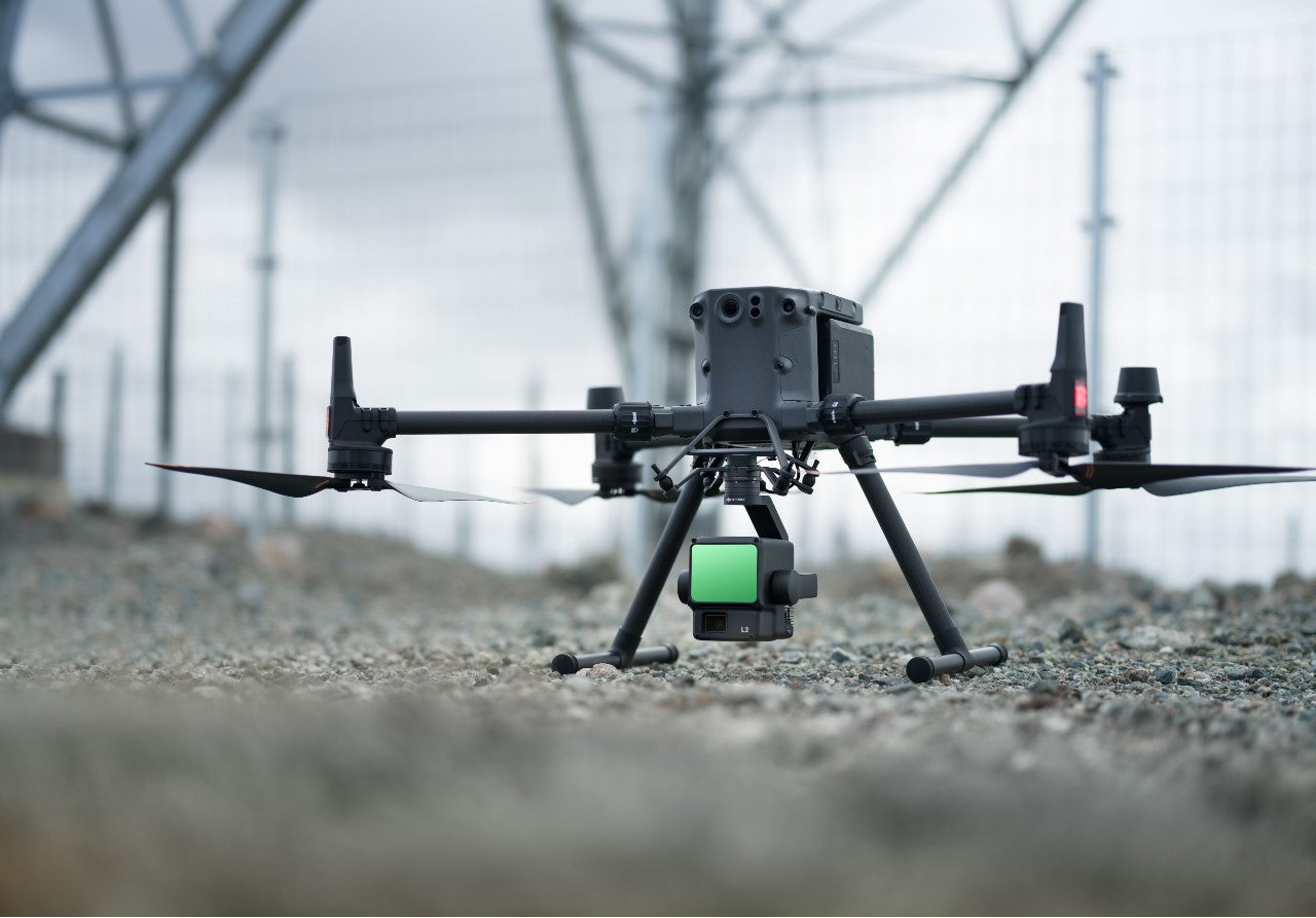
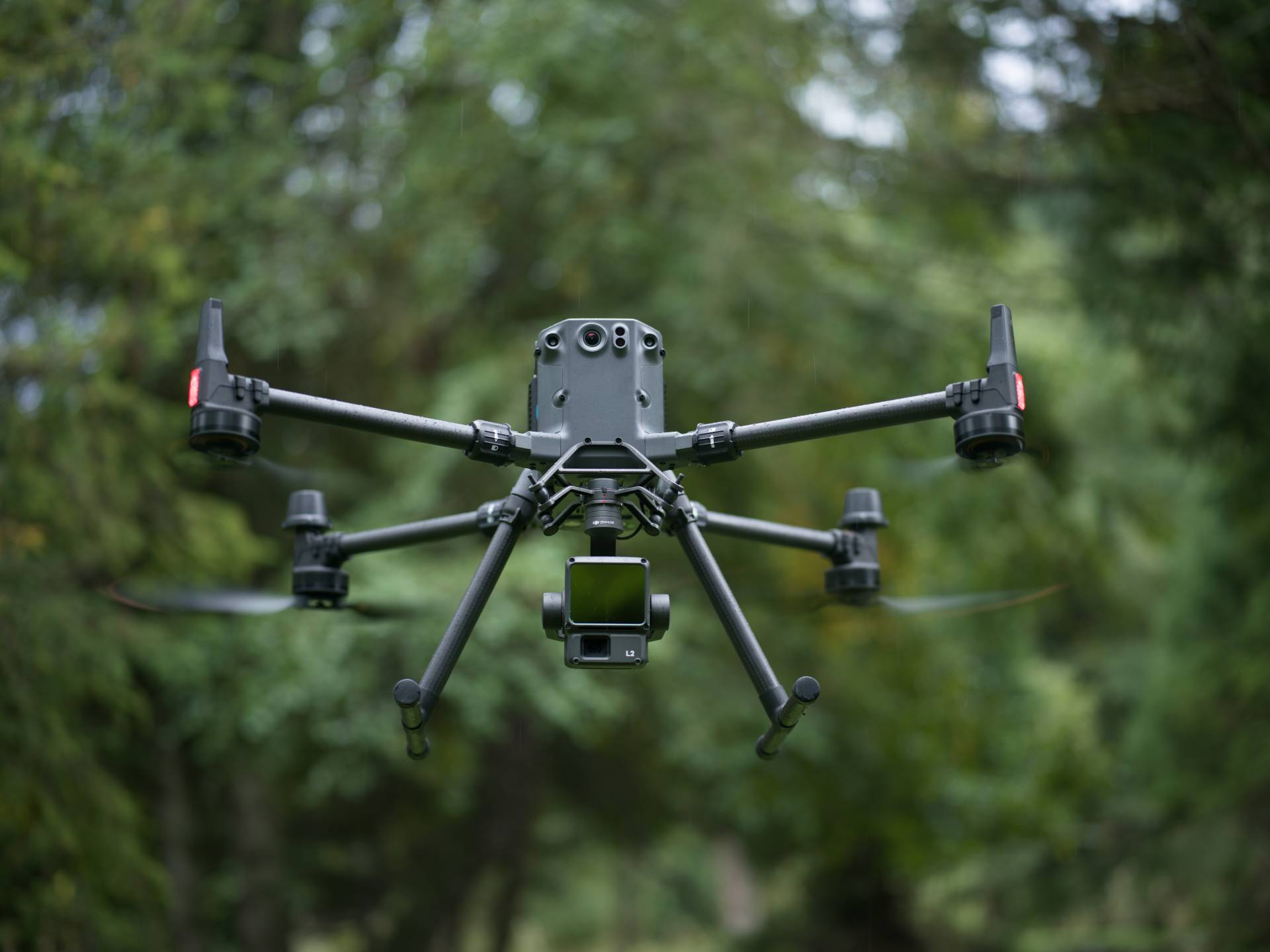
Volatus Drones, a trusted leader in the world of drones and technology, is thrilled to introduce the latest innovation from DJI - the DJI Zenmuse L2. This highly-integrated LiDAR system represents a significant advancement in the field of 3D data collection and builds upon the remarkable success of DJI's Zenmuse L1. With enhanced features, including an upgraded RGB camera, improved LiDAR module, and heightened accuracy, the DJI Zenmuse L2 promises to reshape the way enterprise professionals work with 3D data.
This cutting-edge solution is designed to seamlessly integrate with the DJI Matrice 300 RTK and DJI Matrice 350 RTK platforms, providing users with unparalleled precision, efficiency, and reliability in data acquisition. When coupled with DJI Terra, it forms a comprehensive and powerful solution for 3D data collection and high-accuracy post-processing.
Enhanced Hardware Power & Efficiency
At the core of the Zenmuse L2 lies a combination of advanced technologies, including LiDAR, a self-developed IMU system, a 4/3 CMOS RGB camera, and a three-axis gimbal. This integration empowers professionals across industries such as land surveying, mapping, electricity inspection, forestry, and infrastructure management to acquire large-scale, three-dimensional spatial information more swiftly and accurately than ever before.
The high-accuracy self-developed IMU system is primed for immediate use, ensuring optimal performance in the field. When combined with the drone’s RTK positioning system for post-processing data fusion, it provides access to highly accurate absolute position, speed, and attitude information.
Improved Detection Range & Safety
Compared to its predecessor, the Zenmuse L2 boasts an impressive 30% increase in detection range. It can now detect objects from 250 meters at 10% reflectivity and 100k Lux, extending up to 450 meters at 50% reflectivity and 0k Lux. This expanded operational range not only enhances efficiency but also elevates safety standards, allowing professionals to work with confidence even at greater altitudes.
The Zenmuse L2's reduced spot size, measuring at 4x12 cm @100m, is a fifth of that of the Zenmuse L1, enabling the detection of smaller objects with remarkable detail. With support for five returns, it excels in penetrating dense vegetation, capturing more ground points beneath foliage, and generating highly accurate digital elevation models (DEM).
Software Enhancements
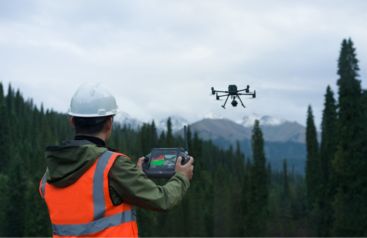
Operational convenience is at the forefront of the Zenmuse L2's design. The DJI Pilot 2 application supports various display modes - RGB, point cloud, and point cloud/RGB side-by-side display - presenting operational results intuitively. The application also offers the capability to activate the Laser Rangefinder (RNG), providing distance information between the LiDAR module and the object at the center of the FOV, enhancing flight safety.
Real-time point cloud coloring modes, including Reflectivity, Height, Distance, and RGB, offer versatile visualization options for operators. Furthermore, the Zenmuse L2 enables quick previews of recorded 3D point cloud models to facilitate real-time monitoring of operational progress.
Through DJI Pilot 2, the Zenmuse L2 can automatically generate route operation quality reports upon completing tasks, complete with point cloud playback and splicing functions. This enables on-site review of point cloud results, allowing for adjustments if necessary, and minimizing the need for rework.
With DJI Terra, post-processing of point cloud data becomes efficient and reliable. The software can generate a 3D point cloud in standard format with a single click after solving the point cloud trajectory and optimizing accuracy. Ground points are classified, and DJI Terra creates the digital elevation model (DEM). The software also offers accuracy control and inspection functions to analyze results thoroughly.
One Tool, Multiple Industries
The DJI Zenmuse L2 is a versatile solution that caters to a wide range of industries. When combined with the DJI Matrice 300 RTK or DJI Matrice 350 RTK platform and DJI Terra, it proves ideal for land surveying, forestry analysis, electricity inspection, and more.
For topographic mapping, the Zenmuse L2 streamlines large-area mapping, enabling professionals to complete topographic surveys quickly and, more importantly, accurately. After collecting raw point cloud data, it can be automatically processed to generate various results, including a 3D point cloud in standard format and digital elevation models (DEMs).
Forestry professionals benefit from the Zenmuse L2's LiDAR capabilities, which can penetrate forest canopies to provide critical data for monitoring plant growth, analyzing crown width, and assessing tree height.
In the electricity inspection industry, the Zenmuse L2 simplifies infrastructure assessment by efficiently collecting point cloud data. Specialists can measure the distance between vegetation and powerlines, identify potential risks, and plan automated inspection missions based on point cloud data.
Unlocking the Potential with Volatus
As you explore the potential of the DJI Zenmuse L2 for your 3D data acquisition needs, Volatus stands ready to assist you. As a trusted source for DJI products and solutions, Volatus offers not only the latest technology but also expertise and support to ensure you maximize the benefits of the Zenmuse L2.
Our team of professionals is well-versed in drone technology and can provide comprehensive information, expert guidance, and reliable support tailored to your specific requirements. When you choose Volatus, you're not just purchasing equipment; you're gaining a valuable partner in your quest for efficiency and precision.
Don't miss the opportunity to harness the power of the DJI Zenmuse L2 for your data acquisition needs. Contact Volatus today, and together, we'll explore the endless possibilities that this cutting-edge technology can unlock for your enterprise.